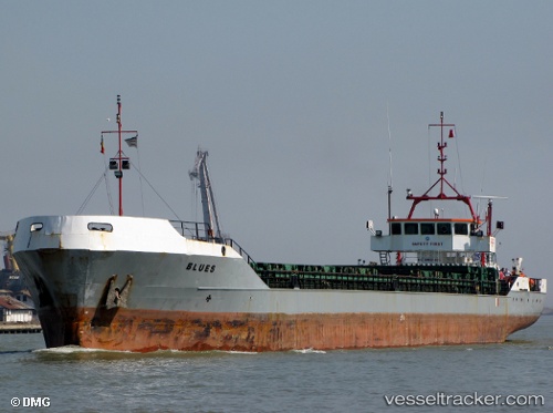
 Blues
Blues
Current Status
Where is the vessel?
Blues is currently in Near Altsi, based on AIS data received about 14h ago.
Latest AIS update:
Current position: 35.18733° N, 25.92499° E (Near Altsi)
Average speed (last 7 days): Loading…
Average speed (last 30 days): Loading…
Vessel profile: Blues is a Multi Purpose Carrier with dimensions 99m x 99m.
This page combines live AIS, route history, probable destination signals, nearby traffic, and port activity for practical vessel monitoring.
The current position of vessel Blues is 35.18733 lat / 25.92499 lng. Updated: 2026-05-23 02:09:18 UTCNearest reference points:
- Near Iraklion
- Near Kali Limenes
- 20 nm S of Astypálaia
Currently sailing under the flag of Cook Is ![]()
Blues built in 1990 year
Deadweight:
3774 tDetails:
Live Vessel Blues Analytics (details, animations, etc.)
Recent AIS points (UTC):
2026-05-22 21:10:12 UTC · 35.18746, 25.92530 · SOG 0 kn · COG -1°2026-05-22 23:45:18 UTC · 35.18732, 25.92493 · SOG 0 kn · COG 350°
2026-05-23 02:09:18 UTC · 35.18733, 25.92499 · SOG 0 kn · COG 344°
2026-05-23 02:09:18 UTC · 35.18733, 25.92499 · SOG 0 kn · COG 344°