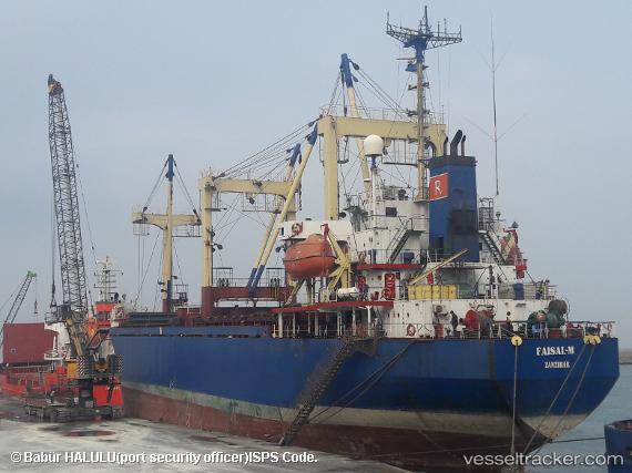
Faisal M
Current StatusWhere is the vessel?
Faisal M is currently in Near Tartous, based on AIS data received about 130d ago.
Latest AIS update:
Current position: 34.90053° N, 35.86268° E (Near Tartous)
Average speed (last 7 days): Loading…
Average speed (last 30 days): Loading…
Vessel profile: Faisal M is a General Cargo Ship with dimensions 19m x 92m.
This page combines live AIS, route history, probable destination signals, nearby traffic, and port activity for practical vessel monitoring.
The current position of vessel Faisal M is 34.90053 lat / 35.86268 lng. Updated: 2026-01-13 14:47:03 UTCNearest reference points:
- Near Tartous
- Near Tripoli
- Near Al Ladhiqiyah
Details:
Live Vessel Faisal M Analytics (details, animations, etc.)
Recent AIS points (UTC):
2026-01-13 14:47:03 UTC · 34.90053, 35.86268 · SOG 0.1 kn · COG -1°