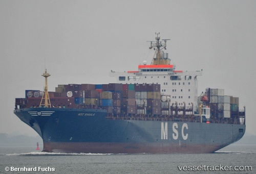
 Msc Shaula
Current Status
Where is the vessel?
Msc Shaula is currently in Near Tianjin Pt, based on AIS data received about 14h ago.
Latest AIS update:
Current position: 39.00053° N, 117.77545° E (Near Tianjin Pt)
Average speed (last 7 days): Loading…
Average speed (last 30 days): Loading…
Vessel profile: Msc Shaula is a Container Ship with dimensions 275m x 37m.
This page combines live AIS, route history, probable destination signals, nearby traffic, and port activity for practical vessel monitoring.
The current position of vessel Msc Shaula is 39.00053 lat / 117.77545 lng. Updated: 2026-05-19 14:03:04 UTCNearest reference points:
- Near Tianjin Pt
- Near Tianjin Xingang Pt
- Near Dagu
Currently sailing under the flag of Liberia ![]()
Msc Shaula built in 1992 year
Deadweight:
61153 tDetails:
Live Vessel Msc Shaula Analytics (details, animations, etc.)
Recent AIS points (UTC):
2026-05-19 11:03:07 UTC · 39.00053, 117.77543 · SOG 0 kn · COG 347°2026-05-19 11:36:07 UTC · 39.00042, 117.77557 · SOG 0 kn · COG 348°
2026-05-19 13:15:03 UTC · 39.00053, 117.77568 · SOG 0.1 kn · COG 348°
2026-05-19 14:03:04 UTC · 39.00053, 117.77545 · SOG 0 kn · COG 348°