 vesseltracker.com
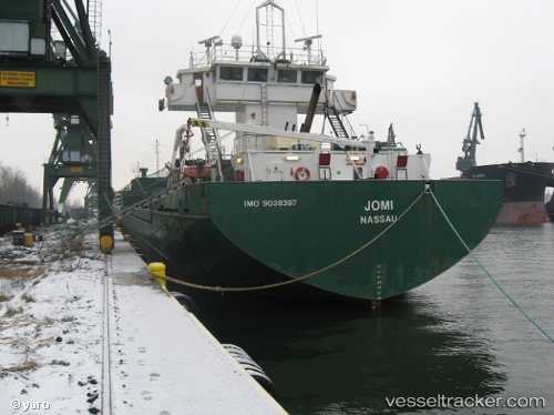
 Jomi
Jomi
Current Status
Where is the vessel?
Jomi is currently in Near Cimdenieki, based on AIS data received about 14h ago.
Latest AIS update:
Current position: 56.54513° N, 21.03808° E (Near Cimdenieki)
Average speed (last 7 days): Loading…
Average speed (last 30 days): Loading…
Vessel profile: Jomi is a Multi Purpose Carrier with dimensions 88m x 14m.
This page combines live AIS, route history, probable destination signals, nearby traffic, and port activity for practical vessel monitoring.
The current position of vessel Jomi is 56.54513 lat / 21.03808 lng. Updated: 2026-05-18 12:08:27 UTCNearest reference points:
- Near Cimdenieki
- Near Klaipeda
- Near Ventspils
Currently sailing under the flag of Bahamas ![]()
Jomi built in 1991 year
Deadweight:
4258 tDetails:
Live Vessel Jomi Analytics (details, animations, etc.)
Recent AIS points (UTC):
2026-05-18 07:38:25 UTC · 56.54192, 21.04373 · SOG 0.1 kn · COG 91°2026-05-18 09:41:27 UTC · 56.54513, 21.03808 · SOG 0 kn · COG 5°
2026-05-18 10:29:17 UTC · 56.54513, 21.03806 · SOG 0 kn · COG -1°
2026-05-18 12:08:27 UTC · 56.54513, 21.03808 · SOG 0 kn · COG 5°