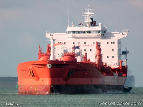
 BOW FAGUS
Current Status
Where is the vessel?
BOW FAGUS is currently in Near Bhavnagar, based on AIS data received about 5d ago.
Latest AIS update:
Current position: 21.78833° N, 72.14333° E (Near Bhavnagar)
Average speed (last 7 days): Loading…
Average speed (last 30 days): Loading…
Vessel profile: BOW FAGUS is a Chemical/Oil Products Tanker with dimensions 184m x 33m.
This page combines live AIS, route history, probable destination signals, nearby traffic, and port activity for practical vessel monitoring.
The current position of vessel BOW FAGUS is 21.78833 lat / 72.14333 lng. Updated: 2026-07-02 10:24:39 UTCNearest reference points:
- Near Bhavnagar
- Near Mithivirdi
- Near DAHEJ
Currently sailing under the flag of Marshall Islands ![]()
BOW FAGUS built in 1995 year
Deadweight:
37375 tDetails:
Live Vessel BOW FAGUS Analytics (details, animations, etc.)
Recent AIS points (UTC):
2026-07-02 10:24:39 UTC · 21.78833, 72.14333 · SOG 0 kn · COG -1°2026-07-02 10:24:39 UTC · 21.78833, 72.14333 · SOG 0 kn · COG -1°
2026-07-02 10:24:39 UTC · 21.78833, 72.14333 · SOG 0 kn · COG -1°
2026-07-02 10:24:39 UTC · 21.78833, 72.14333 · SOG 0 kn · COG -1°