 vesseltracker.com
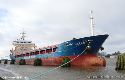
 Lady Hayat
Current Status
Where is the vessel?
Lady Hayat is currently in 18 nm N of Monopoli, based on AIS data received less than 1h ago.
Latest AIS update:
Current position: 41.42298° N, 17.27240° E (18 nm N of Monopoli)
Average speed (last 7 days): Loading…
Average speed (last 30 days): Loading…
Vessel profile: Lady Hayat is a General Cargo Ship with dimensions 94m x 94m.
This page combines live AIS, route history, probable destination signals, nearby traffic, and port activity for practical vessel monitoring.
The current position of vessel Lady Hayat is 41.42298 lat / 17.27240 lng. Updated: 2026-05-15 07:36:23 UTCNearest reference points:
- Near Monopoli
- Near Porto Di Brindisi
- Near Marina di Ginosa
Currently sailing under the flag of Panama ![]()
Lady Hayat built in 1995 year
Deadweight:
5264 tDetails:
Live Vessel Lady Hayat Analytics (details, animations, etc.)
Recent AIS points (UTC):
2026-05-15 04:41:57 UTC · 41.08798, 17.67576 · SOG 9.4 kn · COG 321°2026-05-15 06:21:17 UTC · 41.27897, 17.44924 · SOG 9.3 kn · COG 319°
2026-05-15 07:09:17 UTC · 41.37206, 17.33471 · SOG 9.4 kn · COG 318°
2026-05-15 07:36:23 UTC · 41.42298, 17.27240 · SOG 9.5 kn · COG 316°