 vesseltracker.com
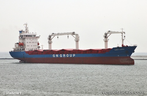
 Lady Leyla
Current Status
Where is the vessel?
Lady Leyla is currently in 26 nm S of Almuñécar, based on AIS data received about 1h ago.
Latest AIS update:
Current position: 36.29383° N, 3.77362° W (26 nm S of Almuñécar)
Average speed (last 7 days): Loading…
Average speed (last 30 days): Loading…
Vessel profile: Lady Leyla is a Multi Purpose Carrier with dimensions 135m x 135m.
This page combines live AIS, route history, probable destination signals, nearby traffic, and port activity for practical vessel monitoring.
The current position of vessel Lady Leyla is 36.29383 lat / -3.77362 lng. Updated: 2026-05-16 03:30:57 UTCNearest reference points:
- 24 nm S of El Morche
- Near MOTRIL
- 23 nm S of Carchuna
Currently sailing under the flag of Panama ![]()
Lady Leyla built in 1995 year
Deadweight:
11366 tDetails:
Live Vessel Lady Leyla Analytics (details, animations, etc.)
Recent AIS points (UTC):
2026-05-15 23:44:37 UTC · 36.37112, -3.72163 · SOG 1.3 kn · COG 141°2026-05-16 01:54:16 UTC · 36.31718, -3.74173 · SOG 1.6 kn · COG 163°
2026-05-16 02:30:15 UTC · 36.30767, -3.75225 · SOG 1.2 kn · COG 158°
2026-05-16 03:30:57 UTC · 36.29383, -3.77362 · SOG 1.1 kn · COG 173°