 ABILITY
Current Status
Where is the vessel?
ABILITY is currently in Near PORT DE BOUC, based on AIS data received about 14h ago.
Latest AIS update:
Current position: 43.39208° N, 4.96675° E (Near PORT DE BOUC)
Average speed (last 7 days): Loading…
Average speed (last 30 days): Loading…
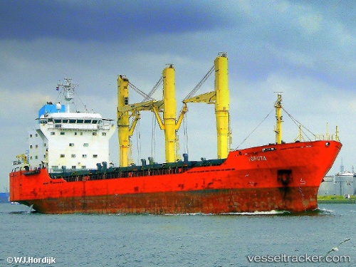
Vessel profile: ABILITY is a General Cargo Ship with dimensions 142m x 23m.
This page combines live AIS, route history, probable destination signals, nearby traffic, and port activity for practical vessel monitoring.
The current position of vessel ABILITY is 43.39208 lat / 4.96675 lng. Updated: 2026-05-19 16:17:59 UTCNearest reference points:
- Near Fos-sur-Mer
- Near SAINT LOUIS DU RHONE
- Near Marseille
Currently sailing under the flag of Panama ![]()
ABILITY built in 1998 year
Deadweight:
17789 tDetails:
Live Vessel ABILITY Analytics (details, animations, etc.)
Recent AIS points (UTC):
2026-05-19 13:11:54 UTC · 43.39187, 4.96704 · SOG 0 kn · COG 226°2026-05-19 13:35:55 UTC · 43.39187, 4.96704 · SOG 0 kn · COG 226°
2026-05-19 15:57:01 UTC · 43.39210, 4.96671 · SOG 0 kn · COG 211°
2026-05-19 16:17:59 UTC · 43.39208, 4.96675 · SOG 0 kn · COG 214°