 vesseltracker.com
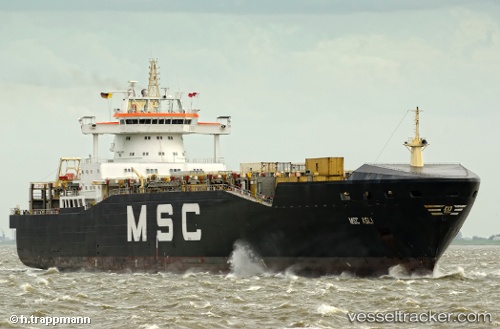
 Msc Asli
Current Status
Where is the vessel?
Msc Asli is currently in Near Riga, based on AIS data received about 1h ago.
Latest AIS update:
Current position: 57.00824° N, 24.09614° E (Near Riga)
Average speed (last 7 days): Loading…
Average speed (last 30 days): Loading…
Vessel profile: Msc Asli is a Container Ship with dimensions 217m x 27m.
This page combines live AIS, route history, probable destination signals, nearby traffic, and port activity for practical vessel monitoring.
The current position of vessel Msc Asli is 57.00824 lat / 24.09614 lng. Updated: 2026-05-14 00:12:53 UTCNearest reference points:
- Near Riga
- Near Bullu
- Near Ristna
Currently sailing under the flag of Liberia ![]()
Msc Asli built in 2000 year
Deadweight:
14150 tDetails:
Live Vessel Msc Asli Analytics (details, animations, etc.)
Recent AIS points (UTC):
2026-05-13 20:17:09 UTC · 57.00829, 24.09619 · SOG 0 kn · COG 354°2026-05-13 21:32:42 UTC · 57.00826, 24.09624 · SOG 0 kn · COG 354°
2026-05-13 22:42:11 UTC · 57.00828, 24.09628 · SOG 0 kn · COG 354°
2026-05-14 00:12:53 UTC · 57.00824, 24.09614 · SOG 0 kn · COG 354°