 Roseline A
Current Status
Where is the vessel?
Roseline A is currently in Near Sousse, based on AIS data received about 15h ago.
Latest AIS update:
Current position: 35.82684° N, 10.64649° E (Near Sousse)
Average speed (last 7 days): Loading…
Average speed (last 30 days): Loading…
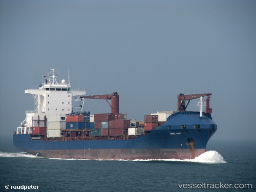
Vessel profile: Roseline A is a Container Ship with dimensions 148m x 24m.
This page combines live AIS, route history, probable destination signals, nearby traffic, and port activity for practical vessel monitoring.
The current position of vessel Roseline A is 35.82684 lat / 10.64649 lng. Updated: 2026-05-21 22:08:51 UTCNearest reference points:
- Near Ksour Essaf
- Near Le Kram
- 13 nm N of Qulaybiyah
Currently sailing under the flag of Turkey ![]()
Roseline A built in 1998 year
Deadweight:
16727 tDetails:
Live Vessel Roseline A Analytics (details, animations, etc.)
Recent AIS points (UTC):
2026-05-21 19:47:51 UTC · 35.82686, 10.64649 · SOG 0 kn · COG 166°2026-05-21 20:11:52 UTC · 35.82685, 10.64651 · SOG 0 kn · COG 166°
2026-05-21 21:53:52 UTC · 35.82685, 10.64650 · SOG 0 kn · COG 166°
2026-05-21 22:08:51 UTC · 35.82684, 10.64649 · SOG 0 kn · COG 165°