 Maxi
Maxi
Current Status
Where is the vessel?
Maxi is currently in 29 nm W of Komiza, based on AIS data received about 14h ago.
Latest AIS update:
Current position: 42.97833° N, 15.42567° E (29 nm W of Komiza)
Average speed (last 7 days): Loading…
Average speed (last 30 days): Loading…
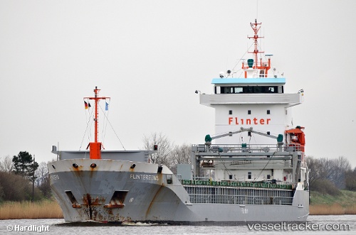
Vessel profile: Maxi is a Multi Purpose Carrier with dimensions 112m x 112m.
This page combines live AIS, route history, probable destination signals, nearby traffic, and port activity for practical vessel monitoring.
The current position of vessel Maxi is 42.97833 lat / 15.42567 lng. Updated: 2026-05-22 10:03:27 UTCNearest reference points:
- 26 nm N of Isole Tremiti
- Near Primosten
- Near Podglavica
Currently sailing under the flag of Antigua Barbuda ![]()
Maxi built in 1999 year
Deadweight:
6359 tDetails:
Live Vessel Maxi Analytics (details, animations, etc.)
Recent AIS points (UTC):
2026-05-22 07:11:38 UTC · 42.64533, 15.80767 · SOG 8.7 kn · COG 320°2026-05-22 08:14:38 UTC · 42.76400, 15.66967 · SOG 9.1 kn · COG 319°
2026-05-22 09:25:57 UTC · 42.90383, 15.50783 · SOG 9.3 kn · COG 323°
2026-05-22 10:03:27 UTC · 42.97833, 15.42567 · SOG 9.2 kn · COG 323°