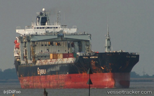
 TEAL ARROW
Current Status
Where is the vessel?
TEAL ARROW is currently in Near Salvador, based on AIS data received about 14h ago.
Latest AIS update:
Current position: 12.96234° S, 38.50799° W (Near Salvador)
Average speed (last 7 days): Loading…
Average speed (last 30 days): Loading…
Vessel profile: TEAL ARROW is a General Cargo Ship with dimensions 173m x 173m.
This page combines live AIS, route history, probable destination signals, nearby traffic, and port activity for practical vessel monitoring.
The current position of vessel TEAL ARROW is -12.96234 lat / -38.50799 lng. Updated: 2026-05-20 04:32:49 UTCNearest reference points:
- Near Aracaju
- Near Barra dos Coqueiros
Currently sailing under the flag of Bahamas ![]()
TEAL ARROW built in 1999 year
Deadweight:
36466 tDetails:
Live Vessel TEAL ARROW Analytics (details, animations, etc.)
Recent AIS points (UTC):
2026-05-20 01:50:50 UTC · -12.96235, -38.50799 · SOG 0 kn · COG 30°2026-05-20 02:11:49 UTC · -12.96239, -38.50796 · SOG 0 kn · COG 30°
2026-05-20 03:23:49 UTC · -12.96234, -38.50799 · SOG 0 kn · COG 30°
2026-05-20 04:32:49 UTC · -12.96234, -38.50799 · SOG 0 kn · COG 30°