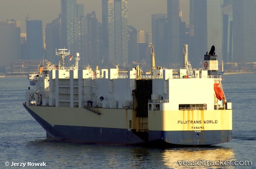
 Fujitrans World
Current Status
Where is the vessel?
Fujitrans World is currently in 46 nm SE of Tsuno, based on AIS data received about 14h ago.
Latest AIS update:
Current position: 31.93500° N, 132.38167° E (46 nm SE of Tsuno)
Average speed (last 7 days): Loading…
Average speed (last 30 days): Loading…
Vessel profile: Fujitrans World is a Vehicles Carrier with dimensions 171m x 25m.
This page combines live AIS, route history, probable destination signals, nearby traffic, and port activity for practical vessel monitoring.
The current position of vessel Fujitrans World is 31.93500 lat / 132.38167 lng. Updated: 2026-05-22 05:01:32 UTCNearest reference points:
- 19 nm SW of Sukumowan
- Near Hyuga
- Near MIYAZAKI
Currently sailing under the flag of Liberia ![]()
Fujitrans World built in 2000 year
Deadweight:
9653 tDetails:
Live Vessel Fujitrans World Analytics (details, animations, etc.)
Recent AIS points (UTC):
2026-05-22 00:58:29 UTC · 32.43833, 133.57666 · SOG 16 kn · COG -1°2026-05-22 00:58:29 UTC · 32.43833, 133.57666 · SOG 16 kn · COG -1°
2026-05-22 02:58:32 UTC · 32.22500, 132.97501 · SOG 16 kn · COG -1°
2026-05-22 05:01:32 UTC · 31.93500, 132.38167 · SOG 17 kn · COG -1°