 W KAMPALA
Current Status
Where is the vessel?
W KAMPALA is currently in Open sea, approx. 402 nm off the nearest listed port, based on AIS data received about 15h ago.
Latest AIS update:
Current position: 30.23967° S, 57.52225° E (Open sea, approx. 402 nm off the nearest listed port)
Average speed (last 7 days): Loading…
Average speed (last 30 days): Loading…
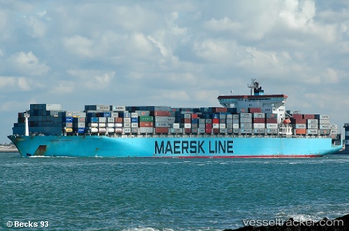
Vessel profile: W KAMPALA is a Container Ship with dimensions 300m x 43m.
This page combines live AIS, route history, probable destination signals, nearby traffic, and port activity for practical vessel monitoring.
The current position of vessel W KAMPALA is -30.23967 lat / 57.52225 lng. Updated: 2026-06-24 14:11:30 UTCNearest reference points:
- Open sea, approx. 402 nm off the nearest listed port
- Open sea, approx. 401 nm off the nearest listed port
- Open sea (no nearby ports in database)
Currently sailing under the flag of Marshall Islands ![]()
W KAMPALA built in 2001 year
Deadweight:
93552 tDetails:
Live Vessel W KAMPALA Analytics (details, animations, etc.)
Recent AIS points (UTC):
2026-06-24 10:19:27 UTC · -30.54667, 56.40500 · SOG 15 kn · COG -1°2026-06-24 11:36:38 UTC · -30.44928, 56.77879 · SOG 15.8 kn · COG 75°
2026-06-24 13:34:56 UTC · -30.28798, 57.34887 · SOG 15.3 kn · COG 74°
2026-06-24 14:11:30 UTC · -30.23967, 57.52225 · SOG 15.3 kn · COG 75°