 Fanaria
Current Status
Where is the vessel?
Fanaria is currently in 12 nm NE of Wedlenstedt, based on AIS data received about 15h ago.
Latest AIS update:
Current position: 52.40879° N, 10.19762° W (12 nm NE of Wedlenstedt)
Average speed (last 7 days): Loading…
Average speed (last 30 days): Loading…
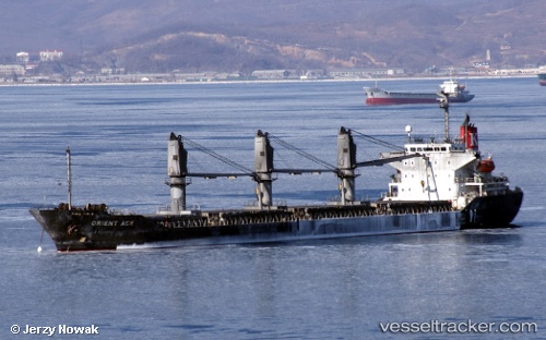
Vessel profile: Fanaria is a Bulk Carrier with dimensions 149m x 23m.
This page combines live AIS, route history, probable destination signals, nearby traffic, and port activity for practical vessel monitoring.
The current position of vessel Fanaria is 52.40879 lat / -10.19762 lng. Updated: 2026-05-19 10:59:36 UTCNearest reference points:
- Near CASTLETOWN BEARHAVEN
- Near Tarbert Island
- Near Skull
Currently sailing under the flag of Panama ![]()
Details:
Live Vessel Fanaria Analytics (details, animations, etc.)
Recent AIS points (UTC):
2026-05-19 07:34:36 UTC · 52.04439, -10.86943 · SOG 10 kn · COG 35°2026-05-19 07:52:06 UTC · 52.08510, -10.82450 · SOG 10.1 kn · COG 36°
2026-05-19 10:15:55 UTC · 52.35128, -10.36782 · SOG 10 kn · COG 60°
2026-05-19 10:59:36 UTC · 52.40879, -10.19762 · SOG 9.7 kn · COG 64°