 Catherine C
Current Status
Where is the vessel?
Catherine C is currently in Open sea (no nearby ports in database), based on AIS data received about 15h ago.
Latest AIS update:
Current position: 11.53853° S, 62.83569° E (Open sea (no nearby ports in database))
Average speed (last 7 days): Loading…
Average speed (last 30 days): Loading…
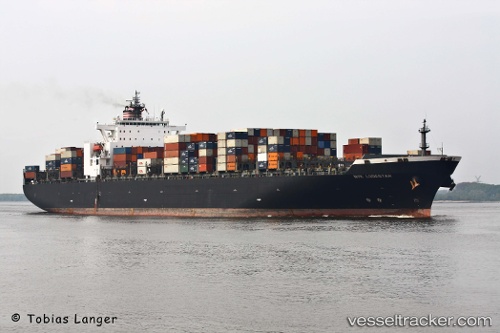
Vessel profile: Catherine C is a Container Ship with dimensions 299m x 40m.
This page combines live AIS, route history, probable destination signals, nearby traffic, and port activity for practical vessel monitoring.
The current position of vessel Catherine C is -11.53853 lat / 62.83569 lng. Updated: 2026-05-22 04:10:07 UTCNearest reference points:
- Open sea (no nearby ports in database)
Currently sailing under the flag of Liberia ![]()
Catherine C built in 2001 year
Deadweight:
77900 tDetails:
Live Vessel Catherine C Analytics (details, animations, etc.)
Recent AIS points (UTC):
2026-05-22 00:50:22 UTC · -10.98992, 63.57103 · SOG 16.2 kn · COG 232°2026-05-22 01:20:39 UTC · -11.07274, 63.45917 · SOG 16.1 kn · COG 232°
2026-05-22 04:09:18 UTC · -11.54173, 62.83152 · SOG 16.9 kn · COG 231°
2026-05-22 04:10:07 UTC · -11.53853, 62.83569 · SOG 17 kn · COG 231°