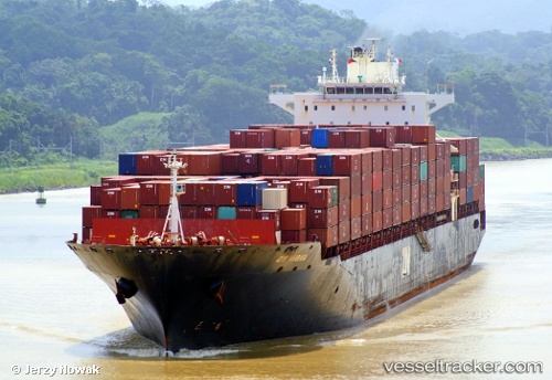
 Zim Virginia
Current Status
Where is the vessel?
Zim Virginia is currently in 88 nm S of CLARK'S HARBOUR, based on AIS data received about 14h ago.
Latest AIS update:
Current position: 42.02333° N, 66.13333° W (88 nm S of CLARK'S HARBOUR)
Average speed (last 7 days): Loading…
Average speed (last 30 days): Loading…
Vessel profile: Zim Virginia is a Container Ship with dimensions 293m x 293m.
This page combines live AIS, route history, probable destination signals, nearby traffic, and port activity for practical vessel monitoring.
The current position of vessel Zim Virginia is 42.02333 lat / -66.13333 lng. Updated: 2026-05-20 23:08:23 UTCNearest reference points:
- Near Lower Woods Harbour
- Near Wedgeport
- 16 nm W of Tiverton
Currently sailing under the flag of Israel ![]()
Zim Virginia built in 2002 year
Deadweight:
66686 tDetails:
Live Vessel Zim Virginia Analytics (details, animations, etc.)
Recent AIS points (UTC):
2026-05-20 17:47:21 UTC · 42.67333, -65.06833 · SOG 12 kn · COG -1°2026-05-20 19:14:21 UTC · 42.48833, -65.35833 · SOG 3 kn · COG -1°
2026-05-20 21:53:22 UTC · 42.18667, -65.86833 · SOG 12 kn · COG -1°
2026-05-20 23:08:23 UTC · 42.02333, -66.13333 · SOG 11 kn · COG -1°