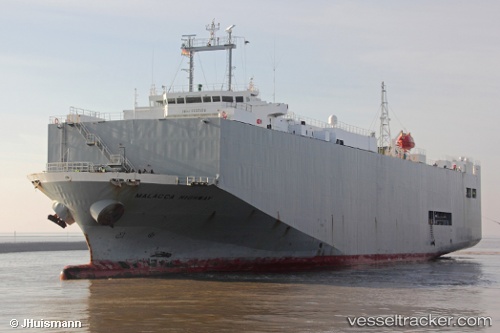
 Malacca Highway
Current Status
Where is the vessel?
Malacca Highway is currently in Near Gdansk, based on AIS data received about 14h ago.
Latest AIS update:
Current position: 54.37996° N, 18.65425° E (Near Gdansk)
Average speed (last 7 days): Loading…
Average speed (last 30 days): Loading…
Vessel profile: Malacca Highway is a Vehicles Carrier with dimensions 139m x 23m.
This page combines live AIS, route history, probable destination signals, nearby traffic, and port activity for practical vessel monitoring.
The current position of vessel Malacca Highway is 54.37996 lat / 18.65425 lng. Updated: 2026-06-20 16:22:45 UTCNearest reference points:
- Near Nowy Port/Gdansk
- Near Górki Zachodnie
- Near Sopot
Currently sailing under the flag of Panama ![]()
Malacca Highway built in 2001 year
Deadweight:
6864 tDetails:
Live Vessel Malacca Highway Analytics (details, animations, etc.)
Recent AIS points (UTC):
2026-06-20 13:25:15 UTC · 54.37996, 18.65424 · SOG 0 kn · COG 75°2026-06-20 13:25:16 UTC · 54.37996, 18.65424 · SOG 0 kn · COG 75°
2026-06-20 16:07:20 UTC · 54.37995, 18.65428 · SOG 0 kn · COG 75°
2026-06-20 16:22:45 UTC · 54.37996, 18.65425 · SOG 0 kn · COG 75°