 vesseltracker.com
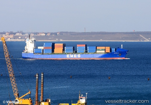
 Yigitcan A
Current Status
Where is the vessel?
Yigitcan A is currently in 43 nm W of Brummana, based on AIS data received about 1h ago.
Latest AIS update:
Current position: 35.83540° N, 34.73240° E (43 nm W of Brummana)
Average speed (last 7 days): Loading…
Average speed (last 30 days): Loading…
Vessel profile: Yigitcan A is a Container Ship with dimensions 156m x 25m.
This page combines live AIS, route history, probable destination signals, nearby traffic, and port activity for practical vessel monitoring.
The current position of vessel Yigitcan A is 35.8354 lat / 34.7324 lng. Updated: 2026-05-14 19:48:38 UTCNearest reference points:
- Near Mersin
- Near Mersin-Free Zone
- Near Al Latakia
Currently sailing under the flag of Malta ![]()
Yigitcan A built in 2001 year
Deadweight:
17264 tDetails:
Live Vessel Yigitcan A Analytics (details, animations, etc.)
Recent AIS points (UTC):
2026-05-14 16:09:11 UTC · 35.15850, 35.21930 · SOG 13.4 kn · COG 337°2026-05-14 18:23:09 UTC · 35.62610, 34.97900 · SOG 12.9 kn · COG 319°
2026-05-14 19:41:00 UTC · 35.82490, 34.75930 · SOG 12.1 kn · COG 309°
2026-05-14 19:48:38 UTC · 35.83540, 34.73240 · SOG 11.5 kn · COG 279°