 vesseltracker.com
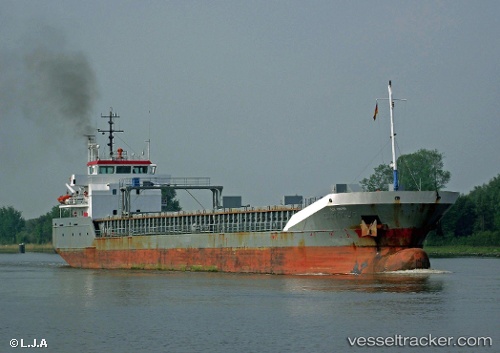
 NATHALIE
Current Status
Where is the vessel?
NATHALIE is currently in 13 nm N of Viinistu Sadam, based on AIS data received less than 1h ago.
Latest AIS update:
Current position: 59.84450° N, 25.59838° E (13 nm N of Viinistu Sadam)
Average speed (last 7 days): Loading…
Average speed (last 30 days): Loading…
Vessel profile: NATHALIE is a General Cargo Ship with dimensions 95m x 13m.
This page combines live AIS, route history, probable destination signals, nearby traffic, and port activity for practical vessel monitoring.
The current position of vessel NATHALIE is 59.84450 lat / 25.59838 lng. Updated: 2026-04-23 11:29:16 UTCNearest reference points:
- 13 nm N of Viinistu Sadam
- Near Vessölandet
- Near Vuosaari (Nordsjö)
Currently sailing under the flag of Finland ![]()
NATHALIE built in 2003 year
Deadweight:
5019 tDetails:
Live Vessel NATHALIE Analytics (details, animations, etc.)
Recent AIS points (UTC):
2026-04-23 07:50:06 UTC · 59.68105, 24.24819 · SOG 11.5 kn · COG 65°2026-04-23 09:56:05 UTC · 59.78274, 25.01593 · SOG 11.6 kn · COG 78°
2026-04-23 10:36:55 UTC · 59.80749, 25.27005 · SOG 11.5 kn · COG 76°
2026-04-23 11:29:16 UTC · 59.84450, 25.59838 · SOG 11.7 kn · COG 77°