 Hope Island
Current Status
Where is the vessel?
Hope Island is currently in 60 nm SE of Abakaliki, based on AIS data received about 18h ago.
Latest AIS update:
Current position: 5.87652° N, 86.88751° E (60 nm SE of Abakaliki)
Average speed (last 7 days): Loading…
Average speed (last 30 days): Loading…
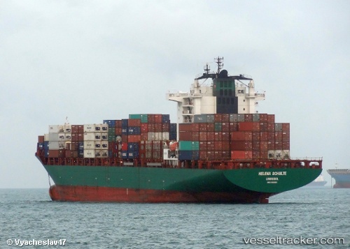
Vessel profile: Hope Island is a Container Ship with dimensions 231m x 32m.
This page combines live AIS, route history, probable destination signals, nearby traffic, and port activity for practical vessel monitoring.
The current position of vessel Hope Island is 5.87652 lat / 86.88751 lng. Updated: 2026-05-25 19:01:00 UTCNearest reference points:
- 23 nm S of Abakaliki
- 46 nm SW of Abakaliki
Currently sailing under the flag of Marshall Is ![]()
Hope Island built in 2006 year
Deadweight:
42106 tDetails:
Live Vessel Hope Island Analytics (details, animations, etc.)
Recent AIS points (UTC):
2026-05-25 19:01:00 UTC · 5.87652, 86.88751 · SOG 15.4 kn · COG 91°2026-05-25 19:01:00 UTC · 5.87652, 86.88751 · SOG 15.4 kn · COG 91°
2026-05-25 19:01:00 UTC · 5.87652, 86.88751 · SOG 15.4 kn · COG 91°
2026-05-25 19:01:00 UTC · 5.87652, 86.88751 · SOG 15.4 kn · COG 91°