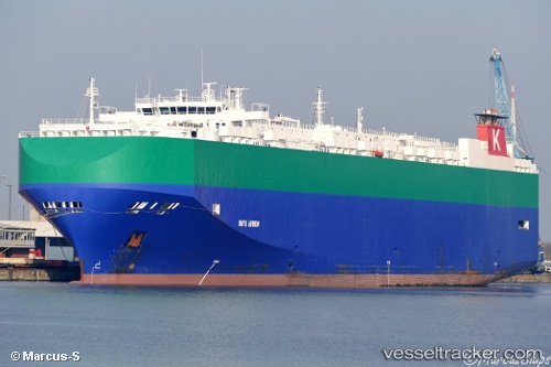
Onyx Arrow
Current StatusWhere is the vessel?
Onyx Arrow is currently in Near Majistan/Zhoushan, based on AIS data received about 14h ago.
Latest AIS update:
Current position: 30.16702° N, 122.02230° E (Near Majistan/Zhoushan)
Average speed (last 7 days): Loading…
Average speed (last 30 days): Loading…
Vessel profile: Onyx Arrow is a Vehicles Carrier with dimensions 32m x 200m.
This page combines live AIS, route history, probable destination signals, nearby traffic, and port activity for practical vessel monitoring.
The current position of vessel Onyx Arrow is 30.16702 lat / 122.02230 lng. Updated: 2026-06-20 05:43:02 UTCNearest reference points:
- Near Majistan/Zhoushan
- 11 nm N of Majistan/Zhoushan
- Near JINHAI HEAVY INDUSTR
Details:
Live Vessel Onyx Arrow Analytics (details, animations, etc.)
Recent AIS points (UTC):
2026-06-20 01:35:35 UTC · 30.16705, 122.02230 · SOG 0 kn · COG 332°2026-06-20 04:11:37 UTC · 30.16705, 122.02230 · SOG 0 kn · COG 332°
2026-06-20 04:23:41 UTC · 30.16704, 122.02231 · SOG 0 kn · COG 332°
2026-06-20 05:43:02 UTC · 30.16702, 122.02230 · SOG 0 kn · COG -1°