 Loch Portain
Current Status
Where is the vessel?
Loch Portain is currently in Near Aird Ma Ruibhe, based on AIS data received about 14h ago.
Latest AIS update:
Current position: 57.69799° N, 7.19074° W (Near Aird Ma Ruibhe)
Average speed (last 7 days): Loading…
Average speed (last 30 days): Loading…
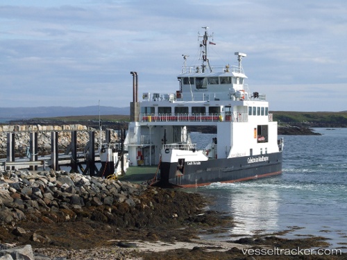
Vessel profile: Loch Portain is a Passenger Ro Ro Cargo Ship with dimensions 48m x 14m.
This page combines live AIS, route history, probable destination signals, nearby traffic, and port activity for practical vessel monitoring.
The current position of vessel Loch Portain is 57.69799 lat / -7.19074 lng. Updated: 2026-05-20 22:13:50 UTCNearest reference points:
- Near North Harris
- Near KYLE OF LOCHALSH
- Near Fishnish, Isle of Mull
Currently sailing under the flag of United Kingdom ![]()
Loch Portain built in 2003 year
Deadweight:
170 tDetails:
Live Vessel Loch Portain Analytics (details, animations, etc.)
Recent AIS points (UTC):
2026-05-20 16:58:49 UTC · 57.69799, -7.19073 · SOG 0 kn · COG 234°2026-05-20 17:34:48 UTC · 57.69799, -7.19074 · SOG 0 kn · COG 234°
2026-05-20 22:07:47 UTC · 57.69799, -7.19074 · SOG 0 kn · COG 233°
2026-05-20 22:13:50 UTC · 57.69799, -7.19074 · SOG 0 kn · COG 233°