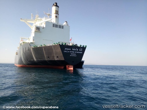
 Lalla Fatma Nsoumer
Current Status
Where is the vessel?
Lalla Fatma Nsoumer is currently in 96 nm E of Ryuo, based on AIS data received about 15h ago.
Latest AIS update:
Current position: 35.58783° N, 18.58683° E (96 nm E of Ryuo)
Average speed (last 7 days): Loading…
Average speed (last 30 days): Loading…
Vessel profile: Lalla Fatma Nsoumer is a Lng Tanker with dimensions 292m x 49m.
This page combines live AIS, route history, probable destination signals, nearby traffic, and port activity for practical vessel monitoring.
The current position of vessel Lalla Fatma Nsoumer is 35.58783 lat / 18.58683 lng. Updated: 2026-05-19 19:10:15 UTCNearest reference points:
- 73 nm N of Pinelands
- 71 nm N of Pinelands
- 103 nm NE of Ryuo
Currently sailing under the flag of Bahamas ![]()
Lalla Fatma Nsoumer built in 2004 year
Deadweight:
80920 tDetails:
Live Vessel Lalla Fatma Nsoumer Analytics (details, animations, etc.)
Recent AIS points (UTC):
2026-05-19 15:25:41 UTC · 35.82667, 17.36833 · SOG 16 kn · COG -1°2026-05-19 17:14:02 UTC · 35.72023, 17.96664 · SOG 16.2 kn · COG 110°
2026-05-19 19:10:15 UTC · 35.58783, 18.58683 · SOG 16 kn · COG 99°
2026-05-19 19:10:15 UTC · 35.58783, 18.58683 · SOG 16 kn · COG 99°