 SPIRIT
Current Status
Where is the vessel?
SPIRIT is currently in 49 nm E of Lince, based on AIS data received about 14h ago.
Latest AIS update:
Current position: 12.01132° N, 76.22506° W (49 nm E of Lince)
Average speed (last 7 days): Loading…
Average speed (last 30 days): Loading…
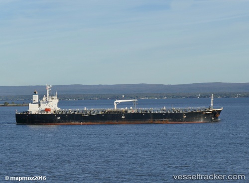
Vessel profile: SPIRIT is a Oil Products Tanker with dimensions 180m x 33m.
This page combines live AIS, route history, probable destination signals, nearby traffic, and port activity for practical vessel monitoring.
The current position of vessel SPIRIT is 12.01132 lat / -76.22506 lng. Updated: 2026-05-20 23:10:44 UTCNearest reference points:
- Near Sociedad Portuaria Regional Cartagena
- Near Contecar
- 18 nm N of Santa Marta
Currently sailing under the flag of Guinea-Bissau ![]()
SPIRIT built in 2004 year
Deadweight:
45879 tDetails:
Live Vessel SPIRIT Analytics (details, animations, etc.)
Recent AIS points (UTC):
2026-05-20 17:55:33 UTC · 12.00128, -76.34242 · SOG 1.3 kn · COG 85°2026-05-20 19:12:04 UTC · 12.00372, -76.31393 · SOG 1.3 kn · COG 85°
2026-05-20 21:57:04 UTC · 12.00898, -76.25249 · SOG 1.3 kn · COG 85°
2026-05-20 23:10:44 UTC · 12.01132, -76.22506 · SOG 1.3 kn · COG 85°