 Suomigracht
Current Status
Where is the vessel?
Suomigracht is currently in Near Talleyrand, based on AIS data received about 15h ago.
Latest AIS update:
Current position: 30.34908° N, 81.62099° W (Near Talleyrand)
Average speed (last 7 days): Loading…
Average speed (last 30 days): Loading…
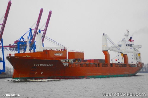
Vessel profile: Suomigracht is a Multi Purpose Carrier with dimensions 186m x 25m.
This page combines live AIS, route history, probable destination signals, nearby traffic, and port activity for practical vessel monitoring.
The current position of vessel Suomigracht is 30.34908 lat / -81.62099 lng. Updated: 2026-07-08 09:54:02 UTCNearest reference points:
- Near Jacksonville
- Near Ponte Vedra
- Near Fernandina
Currently sailing under the flag of Netherlands ![]()
Suomigracht built in 2004 year
Deadweight:
23660 tDetails:
Live Vessel Suomigracht Analytics (details, animations, etc.)
Recent AIS points (UTC):
2026-07-08 07:27:54 UTC · 30.34907, -81.62097 · SOG 0 kn · COG 190°2026-07-08 08:33:13 UTC · 30.34906, -81.62099 · SOG 0 kn · COG 190°
2026-07-08 09:26:42 UTC · 30.34908, -81.62100 · SOG 0 kn · COG 190°
2026-07-08 09:54:02 UTC · 30.34908, -81.62099 · SOG 0 kn · COG 190°