 vesseltracker.com
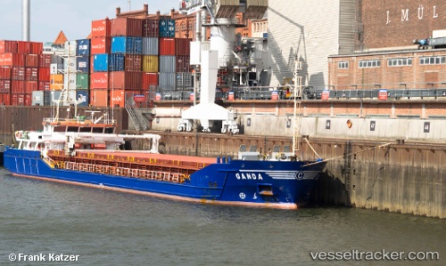
 Ganda
Ganda
Current Status
Where is the vessel?
Ganda is currently in 94 nm SW of Argostolion, based on AIS data received about 1h ago.
Latest AIS update:
Current position: 37.16556° N, 18.91044° E (94 nm SW of Argostolion)
Average speed (last 7 days): Loading…
Average speed (last 30 days): Loading…
Vessel profile: Ganda is a General Cargo Ship with dimensions 79m x 78m.
This page combines live AIS, route history, probable destination signals, nearby traffic, and port activity for practical vessel monitoring.
The current position of vessel Ganda is 37.16556 lat / 18.91044 lng. Updated: 2026-05-14 10:13:57 UTCNearest reference points:
- 103 nm NE of Ryuo
- 64 nm NE of Ryuo
- 53 nm NE of Ryuo
Currently sailing under the flag of Malta ![]()
Ganda built in 2003 year
Deadweight:
2637 tDetails:
Live Vessel Ganda Analytics (details, animations, etc.)
Recent AIS points (UTC):
2026-05-14 04:01:25 UTC · 37.38658, 17.99016 · SOG 7 kn · COG 102°2026-05-14 10:12:29 UTC · 37.16643, 18.90675 · SOG 7.4 kn · COG 101°
2026-05-14 10:13:57 UTC · 37.16556, 18.91044 · SOG 7.4 kn · COG 100°
2026-05-14 10:13:57 UTC · 37.16556, 18.91044 · SOG 7.4 kn · COG 100°