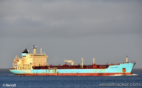
Maersk Bering
Current StatusWhere is the vessel?
Maersk Bering is currently in Near Ardjuna, based on AIS data received about 15h ago.
Latest AIS update:
Current position: 5.84240° S, 105.98850° E (Near Ardjuna)
Average speed (last 7 days): Loading…
Average speed (last 30 days): Loading…
Vessel profile: Maersk Bering is a Chemical Oil Products Tanker with dimensions 29m x 175m.
This page combines live AIS, route history, probable destination signals, nearby traffic, and port activity for practical vessel monitoring.
The current position of vessel Maersk Bering is -5.84240 lat / 105.98850 lng. Updated: 2026-05-22 02:32:44 UTCNearest reference points:
- Near MERAK
- Near SURALAYA
- Near Ardjuna
Details:
Live Vessel Maersk Bering Analytics (details, animations, etc.)
Recent AIS points (UTC):
2026-05-21 21:38:11 UTC · -5.89642, 106.01442 · SOG 0.1 kn · COG -1°2026-05-21 23:04:25 UTC · -5.89641, 106.01443 · SOG 0 kn · COG 220°
2026-05-22 01:16:22 UTC · -5.89642, 106.01442 · SOG 0 kn · COG -1°
2026-05-22 02:32:44 UTC · -5.84240, 105.98850 · SOG 12.4 kn · COG 26°