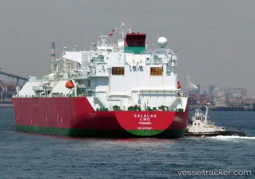
 Salalah Lng
Current Status
Where is the vessel?
Salalah Lng is currently in 37 nm SE of Lushun New Pt, based on AIS data received about 121d ago.
Latest AIS update:
Current position: 38.28645° N, 121.78932° E (37 nm SE of Lushun New Pt)
Average speed (last 7 days): Loading…
Average speed (last 30 days): Loading…
Vessel profile: Salalah Lng is a Lng Tanker with dimensions 285m x 285m.
This page combines live AIS, route history, probable destination signals, nearby traffic, and port activity for practical vessel monitoring.
The current position of vessel Salalah Lng is 38.28645 lat / 121.78932 lng. Updated: 2026-01-21 14:20:06 UTCNearest reference points:
- 26 nm N of Weihaiwei
- 16 nm SE of Dashihuagang
- 23 nm SE of Lushun New Pt
Currently sailing under the flag of Panama ![]()
Salalah Lng built in 2005 year
Deadweight:
81034 tDetails:
Live Vessel Salalah Lng Analytics (details, animations, etc.)
Recent AIS points (UTC):
2026-01-21 14:20:06 UTC · 38.28645, 121.78932 · SOG 16.6 kn · COG 311°