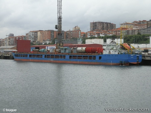
Tanais
Current StatusWhere is the vessel?
Tanais is currently in Near Sigri Lesvou, based on AIS data received about 14h ago.
Latest AIS update:
Current position: 39.36503° N, 25.76668° E (Near Sigri Lesvou)
Average speed (last 7 days): Loading…
Average speed (last 30 days): Loading…
Vessel profile: Tanais is a General Cargo Ship with dimensions 16m x 139m.
This page combines live AIS, route history, probable destination signals, nearby traffic, and port activity for practical vessel monitoring.
The current position of vessel Tanais is 39.36503 lat / 25.76668 lng. Updated: 2026-06-24 10:33:18 UTCNearest reference points:
- 16 nm NW of Sigri Lesvou
- 14 nm NW of Baba Point
- Near Baba Point
Details:
Live Vessel Tanais Analytics (details, animations, etc.)
Recent AIS points (UTC):
2026-06-24 05:36:38 UTC · 38.90053, 26.15781 · SOG 7.6 kn · COG 280°2026-06-24 07:53:29 UTC · 39.05200, 25.86376 · SOG 7.4 kn · COG 318°
2026-06-24 08:13:39 UTC · 39.08225, 25.83190 · SOG 6.6 kn · COG 318°
2026-06-24 10:33:18 UTC · 39.36503, 25.76668 · SOG 7.7 kn · COG 358°