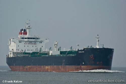
 LYDIA KA
Current Status
Where is the vessel?
LYDIA KA is currently in Near KULEVI, based on AIS data received about 21h ago.
Latest AIS update:
Current position: 42.27472° N, 41.63696° E (Near KULEVI)
Average speed (last 7 days): Loading…
Average speed (last 30 days): Loading…
Vessel profile: LYDIA KA is a Chemical Oil Products Tanker with dimensions 182m x 182m.
This page combines live AIS, route history, probable destination signals, nearby traffic, and port activity for practical vessel monitoring.
The current position of vessel LYDIA KA is 42.27472 lat / 41.63696 lng. Updated: 2026-05-20 13:10:54 UTCNearest reference points:
- Near KULEVI
- Near Poti
- Near Sup'sa
Currently sailing under the flag of Marshall Is ![]()
LYDIA KA built in 2007 year
Deadweight:
37258 tDetails:
Live Vessel LYDIA KA Analytics (details, animations, etc.)
Recent AIS points (UTC):
2026-05-20 13:10:54 UTC · 42.27472, 41.63696 · SOG 0 kn · COG -1°2026-05-20 13:10:54 UTC · 42.27472, 41.63696 · SOG 0 kn · COG -1°
2026-05-20 13:10:54 UTC · 42.27472, 41.63696 · SOG 0 kn · COG -1°
2026-05-20 13:10:54 UTC · 42.27472, 41.63696 · SOG 0 kn · COG -1°