 ORITA
ORITA
Current Status
Where is the vessel?
ORITA is currently in Near Krymsk, based on AIS data received about 15h ago.
Latest AIS update:
Current position: 44.82017° N, 37.90912° E (Near Krymsk)
Average speed (last 7 days): Loading…
Average speed (last 30 days): Loading…
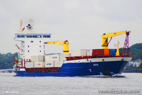
Vessel profile: ORITA is a Container Ship with dimensions 132m x 19m.
This page combines live AIS, route history, probable destination signals, nearby traffic, and port activity for practical vessel monitoring.
The current position of vessel ORITA is 44.82017 lat / 37.90912 lng. Updated: 2026-05-21 22:37:01 UTCNearest reference points:
- Near Novorossiysk
- Near GELENDZHIK
- Near Cpc Terminal
Currently sailing under the flag of Panama ![]()
ORITA built in 2005 year
Deadweight:
7993 tDetails:
Live Vessel ORITA Analytics (details, animations, etc.)
Recent AIS points (UTC):
2026-05-21 16:23:21 UTC · 44.26099, 37.84383 · SOG 9.8 kn · COG 35°2026-05-21 19:18:17 UTC · 44.62080, 37.82782 · SOG 5.7 kn · COG 51°
2026-05-21 21:46:23 UTC · 44.69744, 37.50563 · SOG 2.2 kn · COG 58°
2026-05-21 22:37:01 UTC · 44.82017, 37.90912 · SOG 17.2 kn · COG 15°