 vesseltracker.com
 Msc Amanda F
Current Status
Where is the vessel?
Msc Amanda F is currently in 37 nm NW of Moulay Bou Selham, based on AIS data received about 1h ago.
Latest AIS update:
Current position: 35.14628° N, 6.94458° W (37 nm NW of Moulay Bou Selham)
Average speed (last 7 days): Loading…
Average speed (last 30 days): Loading…
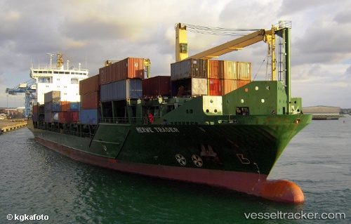
Vessel profile: Msc Amanda F is a Container Ship with dimensions 138m x 22m.
This page combines live AIS, route history, probable destination signals, nearby traffic, and port activity for practical vessel monitoring.
The current position of vessel Msc Amanda F is 35.14628 lat / -6.94458 lng. Updated: 2026-04-28 18:08:27 UTCNearest reference points:
- 45 nm W of Gibraltar
- Near Gibraltar
- Near Conil de la Frontera
Currently sailing under the flag of Portugal ![]()
Msc Amanda F built in 2006 year
Deadweight:
11842 tDetails:
Live Vessel Msc Amanda F Analytics (details, animations, etc.)
Recent AIS points (UTC):
2026-04-28 13:46:17 UTC · 34.44981, -7.77724 · SOG 13.4 kn · COG 43°2026-04-28 15:35:07 UTC · 34.74878, -7.43623 · SOG 13.3 kn · COG 47°
2026-04-28 16:42:57 UTC · 34.92528, -7.21541 · SOG 13.3 kn · COG 47°
2026-04-28 18:08:27 UTC · 35.14628, -6.94458 · SOG 13.6 kn · COG 46°