 Alexandra A
Current Status
Where is the vessel?
Alexandra A is currently in 11 nm S of Kumburgaz, based on AIS data received about 14h ago.
Latest AIS update:
Current position: 40.85811° N, 28.36823° E (11 nm S of Kumburgaz)
Average speed (last 7 days): Loading…
Average speed (last 30 days): Loading…
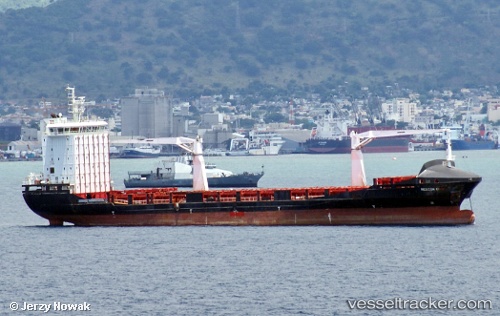
Vessel profile: Alexandra A is a General Cargo Ship with dimensions 145m x 22m.
This page combines live AIS, route history, probable destination signals, nearby traffic, and port activity for practical vessel monitoring.
The current position of vessel Alexandra A is 40.85811 lat / 28.36823 lng. Updated: 2026-05-21 08:16:11 UTCNearest reference points:
- Near Gürpinar
- Near Ambarli
- Near Küçükçekmece
Currently sailing under the flag of Malta ![]()
Alexandra A built in 2011 year
Deadweight:
12099 tDetails:
Live Vessel Alexandra A Analytics (details, animations, etc.)
Recent AIS points (UTC):
2026-05-21 04:33:46 UTC · 40.94593, 28.76471 · SOG 0.1 kn · COG 221°2026-05-21 05:21:44 UTC · 40.94604, 28.76434 · SOG 0 kn · COG 212°
2026-05-21 07:21:44 UTC · 40.87716, 28.54103 · SOG 8.9 kn · COG 262°
2026-05-21 08:16:11 UTC · 40.85811, 28.36823 · SOG 8.7 kn · COG 265°