 LENI
LENI
Current Status
Where is the vessel?
LENI is currently in 109 nm E of MANGALIA, based on AIS data received about 21h ago.
Latest AIS update:
Current position: 43.59886° N, 31.07941° E (109 nm E of MANGALIA)
Average speed (last 7 days): Loading…
Average speed (last 30 days): Loading…
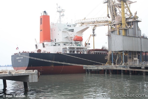
Vessel profile: LENI is a Bulk Carrier with dimensions 33m x 225m.
This page combines live AIS, route history, probable destination signals, nearby traffic, and port activity for practical vessel monitoring.
The current position of vessel LENI is 43.59886 lat / 31.07941 lng. Updated: 2026-05-20 17:41:00 UTCNearest reference points:
- 54 nm SE of Sveti Nikola
- 13 nm E of Sulina (Port et Zone Franche)
- 12 nm SE of Sulina (Port et Zone Franche)
Currently sailing under the flag of Marshall Islands ![]()
LENI built in 2008 year
Deadweight:
77008 tDetails:
Live Vessel LENI Analytics (details, animations, etc.)
Recent AIS points (UTC):
2026-05-20 17:41:00 UTC · 43.59886, 31.07941 · SOG 0.6 kn · COG 107°2026-05-20 17:41:00 UTC · 43.59886, 31.07941 · SOG 0.6 kn · COG 107°
2026-05-20 17:41:00 UTC · 43.59886, 31.07941 · SOG 0.6 kn · COG 107°
2026-05-20 17:41:00 UTC · 43.59886, 31.07941 · SOG 0.6 kn · COG 107°