 Nevzat Kalkavan
Current Status
Where is the vessel?
Nevzat Kalkavan is currently in 86 nm SW of Seica, based on AIS data received about 14h ago.
Latest AIS update:
Current position: 38.75727° N, 50.80817° W (86 nm SW of Seica)
Average speed (last 7 days): Loading…
Average speed (last 30 days): Loading…
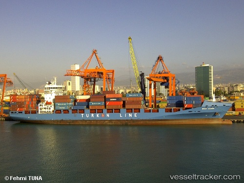
Vessel profile: Nevzat Kalkavan is a Container Ship with dimensions 183m x 28m.
This page combines live AIS, route history, probable destination signals, nearby traffic, and port activity for practical vessel monitoring.
The current position of vessel Nevzat Kalkavan is 38.75727 lat / -50.80817 lng. Updated: 2026-05-21 07:11:36 UTCNearest reference points:
- 76 nm SW of Seica
- 63 nm SE of Azuara
- 44 nm SE of Jonesville
Currently sailing under the flag of Turkey ![]()
Nevzat Kalkavan built in 2011 year
Deadweight:
26811 tDetails:
Live Vessel Nevzat Kalkavan Analytics (details, animations, etc.)
Recent AIS points (UTC):
2026-05-21 03:58:47 UTC · 38.76039, -51.87175 · SOG 15.3 kn · COG 89°2026-05-21 05:07:34 UTC · 38.75688, -51.49446 · SOG 15.3 kn · COG 89°
2026-05-21 07:11:36 UTC · 38.75727, -50.80817 · SOG 15.4 kn · COG 90°
2026-05-21 07:11:36 UTC · 38.75727, -50.80817 · SOG 15.4 kn · COG 90°