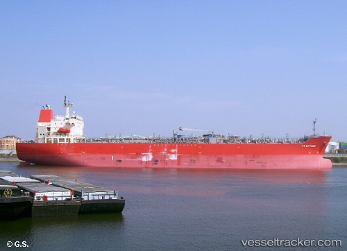
Ivy Express
Current StatusWhere is the vessel?
Ivy Express is currently in Near Yanbu Industrial City, based on AIS data received about 15h ago.
Latest AIS update:
Current position: 23.94404° N, 38.19531° E (Near Yanbu Industrial City)
Average speed (last 7 days): Loading…
Average speed (last 30 days): Loading…
Vessel profile: Ivy Express is a Chemical Oil Products Tanker with dimensions 32m x 184m.
This page combines live AIS, route history, probable destination signals, nearby traffic, and port activity for practical vessel monitoring.
The current position of vessel Ivy Express is 23.94404 lat / 38.19531 lng. Updated: 2026-05-20 23:55:48 UTCNearest reference points:
- 30 nm SW of Yanbu
- 42 nm NW of Fiji
- 35 nm S of Umm Lajj
Details:
Live Vessel Ivy Express Analytics (details, animations, etc.)
Recent AIS points (UTC):
2026-05-20 21:52:49 UTC · 23.94390, 38.19515 · SOG 0 kn · COG 301°2026-05-20 22:16:51 UTC · 23.94405, 38.19525 · SOG 0.1 kn · COG 292°
2026-05-20 23:55:48 UTC · 23.94404, 38.19531 · SOG 0.1 kn · COG 297°
2026-05-20 23:55:48 UTC · 23.94404, 38.19531 · SOG 0.1 kn · COG 297°