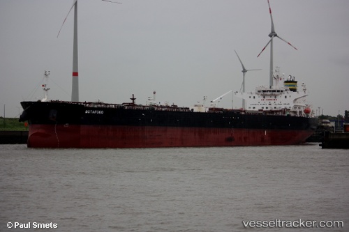
 Botafogo
Current Status
Where is the vessel?
Botafogo is currently in 15 nm N of Mondello, Palermo, based on AIS data received about 14h ago.
Latest AIS update:
Current position: 38.44246° N, 13.36391° E (15 nm N of Mondello, Palermo)
Average speed (last 7 days): Loading…
Average speed (last 30 days): Loading…
Vessel profile: Botafogo is a Crude Oil Tanker with dimensions 244m x 244m.
This page combines live AIS, route history, probable destination signals, nearby traffic, and port activity for practical vessel monitoring.
The current position of vessel Botafogo is 38.44246 lat / 13.36391 lng. Updated: 2026-05-19 16:20:32 UTCNearest reference points:
- Near Palermo
- Near Balestrate
- Near Trapani
Currently sailing under the flag of Malta ![]()
Botafogo built in 2010 year
Deadweight:
106892 tDetails:
Live Vessel Botafogo Analytics (details, animations, etc.)
Recent AIS points (UTC):
2026-05-19 13:12:01 UTC · 38.39863, 13.90785 · SOG 8.2 kn · COG 280°2026-05-19 13:34:46 UTC · 38.40371, 13.84264 · SOG 8.1 kn · COG 280°
2026-05-19 15:57:41 UTC · 38.44294, 13.43076 · SOG 8.1 kn · COG 283°
2026-05-19 16:20:32 UTC · 38.44246, 13.36391 · SOG 8.3 kn · COG 278°