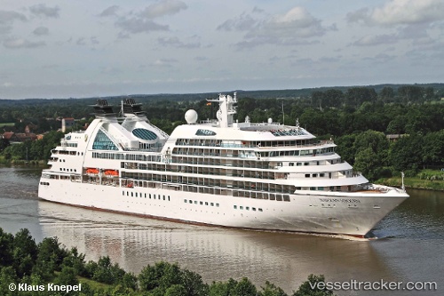
 SEABOURN SOJOURN
Current Status
Where is the vessel?
SEABOURN SOJOURN is currently in Near FUKABORI, based on AIS data received about 24d ago.
Latest AIS update:
Current position: 32.70522° N, 129.82639° E (Near FUKABORI)
Average speed (last 7 days): Loading…
Average speed (last 30 days): Loading…
Vessel profile: SEABOURN SOJOURN is a Passenger Ship with dimensions 197m x 29m.
This page combines live AIS, route history, probable destination signals, nearby traffic, and port activity for practical vessel monitoring.
The current position of vessel SEABOURN SOJOURN is 32.70522 lat / 129.82639 lng. Updated: 2026-06-05 19:41:54 UTCNearest reference points:
- Near FUKABORI
- Near MATSUSHIMA
- Near Fukushima, Nagasaki
Currently sailing under the flag of Bahamas ![]()
SEABOURN SOJOURN built in 2010 year
Deadweight:
3780 tDetails:
Live Vessel SEABOURN SOJOURN Analytics (details, animations, etc.)
Recent AIS points (UTC):
2026-06-05 19:41:54 UTC · 32.70522, 129.82639 · SOG 0 kn · COG 287°