 vesseltracker.com
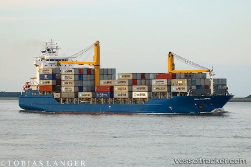
 JULIUS
Current Status
Where is the vessel?
JULIUS is currently in Near PSYTTALEIA, based on AIS data received less than 1h ago.
Latest AIS update:
Current position: 37.95621° N, 23.58551° E (Near PSYTTALEIA)
Average speed (last 7 days): Loading…
Average speed (last 30 days): Loading…
Vessel profile: JULIUS is a Container Ship with dimensions 161m x 25m.
This page combines live AIS, route history, probable destination signals, nearby traffic, and port activity for practical vessel monitoring.
The current position of vessel JULIUS is 37.95621 lat / 23.58551 lng. Updated: 2026-05-15 18:16:26 UTCNearest reference points:
- Near Keratsínion
- Near PERAMA
- Near Drapetzona
Currently sailing under the flag of Antigua and Barbuda ![]()
JULIUS built in 2009 year
Deadweight:
16908 tDetails:
Live Vessel JULIUS Analytics (details, animations, etc.)
Recent AIS points (UTC):
2026-05-15 13:58:28 UTC · 37.95622, 23.58550 · SOG 0 kn · COG 346°2026-05-15 16:10:27 UTC · 37.95621, 23.58551 · SOG 0 kn · COG 346°
2026-05-15 17:04:28 UTC · 37.95621, 23.58550 · SOG 0.2 kn · COG 346°
2026-05-15 18:16:26 UTC · 37.95621, 23.58551 · SOG 0 kn · COG 347°