 Mikela P.
Current Status
Where is the vessel?
Mikela P. is currently in 45 nm SE of Quintana, based on AIS data received about 14h ago.
Latest AIS update:
Current position: 28.26755° N, 94.88838° W (45 nm SE of Quintana)
Average speed (last 7 days): Loading…
Average speed (last 30 days): Loading…
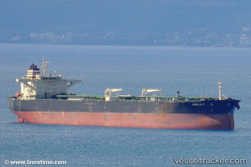
Vessel profile: Mikela P. is a Crude Oil Tanker with dimensions 274m x 48m.
This page combines live AIS, route history, probable destination signals, nearby traffic, and port activity for practical vessel monitoring.
The current position of vessel Mikela P. is 28.26755 lat / -94.88838 lng. Updated: 2026-06-14 22:23:26 UTCNearest reference points:
- 56 nm SE of Quintana
- 63 nm SE of Quintana
- 39 nm S of Sheppard
Currently sailing under the flag of Marshall Is ![]()
Mikela P. built in 2009 year
Deadweight:
158007 tDetails:
Live Vessel Mikela P. Analytics (details, animations, etc.)
Recent AIS points (UTC):
2026-06-14 19:56:44 UTC · 28.21667, -94.94333 · SOG 2 kn · COG -1°2026-06-14 20:06:46 UTC · 28.22090, -94.93955 · SOG 1.8 kn · COG 65°
2026-06-14 21:27:07 UTC · 28.25070, -94.90857 · SOG 1.6 kn · COG 75°
2026-06-14 22:23:26 UTC · 28.26755, -94.88838 · SOG 1.4 kn · COG 71°