 vesseltracker.com
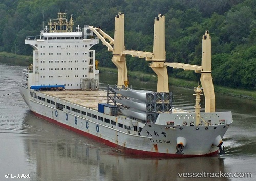
Da Cai Yun
Current StatusWhere is the vessel?
Da Cai Yun is currently in 12 nm NW of AL HAMRA, based on AIS data received about 1h ago.
Latest AIS update:
Current position: 25.82465° N, 55.61608° E (12 nm NW of AL HAMRA)
Average speed (last 7 days): Loading…
Average speed (last 30 days): Loading…
Vessel profile: Da Cai Yun is a Multi Purpose Carrier with dimensions 27m x 166m.
This page combines live AIS, route history, probable destination signals, nearby traffic, and port activity for practical vessel monitoring.
The current position of vessel Da Cai Yun is 25.82465 lat / 55.61608 lng. Updated: 2026-05-01 19:42:48 UTCNearest reference points:
- 13 nm NW of Hulaylah Terminal
- Near Hulaylah Terminal
- Near Ras Al Khaimah
Details:
Live Vessel Da Cai Yun Analytics (details, animations, etc.)
Recent AIS points (UTC):
2026-05-01 16:58:09 UTC · 25.82509, 55.61314 · SOG 0 kn · COG 51°2026-05-01 18:15:45 UTC · 25.82438, 55.61332 · SOG 0 kn · COG 20°
2026-05-01 19:27:40 UTC · 25.82478, 55.61615 · SOG 0 kn · COG 309°
2026-05-01 19:42:48 UTC · 25.82465, 55.61608 · SOG 0 kn · COG 312°