 PORTARIA
Current Status
Where is the vessel?
PORTARIA is currently in Near PORT DE BOUC, based on AIS data received about 14h ago.
Latest AIS update:
Current position: 43.34571° N, 4.93633° E (Near PORT DE BOUC)
Average speed (last 7 days): Loading…
Average speed (last 30 days): Loading…
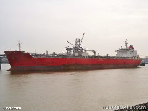
Vessel profile: PORTARIA is a Chemical/Oil Products Tanker with dimensions 27m x 183m.
This page combines live AIS, route history, probable destination signals, nearby traffic, and port activity for practical vessel monitoring.
The current position of vessel PORTARIA is 43.34571 lat / 4.93633 lng. Updated: 2026-05-20 11:51:22 UTCNearest reference points:
- Near SAINT LOUIS DU RHONE
- Near Fos-sur-Mer
- Near Marseille
Currently sailing under the flag of Malta ![]()
PORTARIA built in 2010 year
Deadweight:
36686 tDetails:
Live Vessel PORTARIA Analytics (details, animations, etc.)
Recent AIS points (UTC):
2026-05-20 08:06:24 UTC · 43.34576, 4.93516 · SOG 0.1 kn · COG 355°2026-05-20 09:39:20 UTC · 43.34558, 4.93609 · SOG 0 kn · COG 322°
2026-05-20 10:27:27 UTC · 43.34500, 4.93500 · SOG 0 kn · COG -1°
2026-05-20 11:51:22 UTC · 43.34571, 4.93633 · SOG 0 kn · COG 313°