 vesseltracker.com
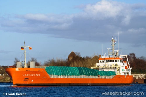
 Lady Hester
Current Status
Where is the vessel?
Lady Hester is currently in Near Bettystown, based on AIS data received about 1h ago.
Latest AIS update:
Current position: 53.72135° N, 6.22249° W (Near Bettystown)
Average speed (last 7 days): Loading…
Average speed (last 30 days): Loading…
Vessel profile: Lady Hester is a General Cargo Ship with dimensions 97m x 14m.
This page combines live AIS, route history, probable destination signals, nearby traffic, and port activity for practical vessel monitoring.
The current position of vessel Lady Hester is 53.72135 lat / -6.22249 lng. Updated: 2026-05-13 19:40:15 UTCNearest reference points:
- Near Skerries
- Near GREENORE
- Near Greencastle
Currently sailing under the flag of Netherlands ![]()
Lady Hester built in 2011 year
Deadweight:
3500 tDetails:
Live Vessel Lady Hester Analytics (details, animations, etc.)
Recent AIS points (UTC):
2026-05-13 16:24:04 UTC · 53.74495, -6.17194 · SOG 0.3 kn · COG 315°2026-05-13 18:06:06 UTC · 53.74480, -6.17253 · SOG 0.4 kn · COG 351°
2026-05-13 19:05:25 UTC · 53.74448, -6.16901 · SOG 2.6 kn · COG 184°
2026-05-13 19:40:15 UTC · 53.72135, -6.22249 · SOG 7.6 kn · COG 275°