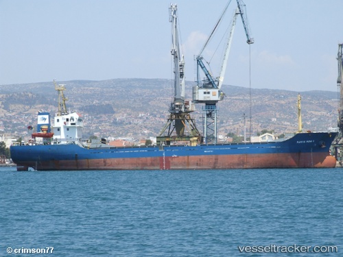
 TOLMI
TOLMI
Current Status
Where is the vessel?
TOLMI is currently in Near Burgas, based on AIS data received about 15h ago.
Latest AIS update:
Current position: 42.48403° N, 27.45197° E (Near Burgas)
Average speed (last 7 days): Loading…
Average speed (last 30 days): Loading…
Vessel profile: TOLMI is a General Cargo Ship with dimensions 81m x 14m.
This page combines live AIS, route history, probable destination signals, nearby traffic, and port activity for practical vessel monitoring.
The current position of vessel TOLMI is 42.48403 lat / 27.45197 lng. Updated: 2026-06-13 04:26:22 UTCNearest reference points:
- Near Beloslav
- Near Ignatievo
- Near Varna
Currently sailing under the flag of Liberia ![]()
TOLMI built in 2007 year
Deadweight:
3331 tDetails:
Live Vessel TOLMI Analytics (details, animations, etc.)
Recent AIS points (UTC):
2026-06-13 01:20:01 UTC · 42.48403, 27.45197 · SOG 0 kn · COG 33°2026-06-13 01:20:01 UTC · 42.48403, 27.45197 · SOG 0 kn · COG 33°
2026-06-13 04:20:01 UTC · 42.48404, 27.45193 · SOG 0.1 kn · COG 34°
2026-06-13 04:26:22 UTC · 42.48403, 27.45197 · SOG 0 kn · COG 34°