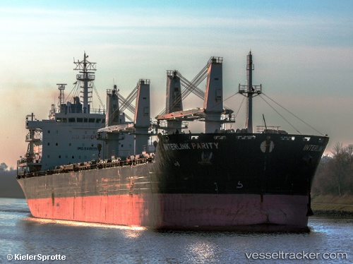
Interlink Parity
Current StatusWhere is the vessel?
Interlink Parity is currently in Near Casablanca, based on AIS data received about 14h ago.
Latest AIS update:
Current position: 33.69332° N, 7.72846° W (Near Casablanca)
Average speed (last 7 days): Loading…
Average speed (last 30 days): Loading…
Vessel profile: Interlink Parity is a Bulk Carrier with dimensions 29m x 190m.
This page combines live AIS, route history, probable destination signals, nearby traffic, and port activity for practical vessel monitoring.
The current position of vessel Interlink Parity is 33.69332 lat / -7.72846 lng. Updated: 2026-05-19 03:44:41 UTCNearest reference points:
- Near Mohammedia
- 54 nm N of El Jadida
- Near Jorf Lasfar
Details:
Live Vessel Interlink Parity Analytics (details, animations, etc.)
Recent AIS points (UTC):
2026-05-18 23:56:39 UTC · 33.69316, -7.72820 · SOG 0.1 kn · COG 39°2026-05-19 01:29:41 UTC · 33.69297, -7.72771 · SOG 0.4 kn · COG 22°
2026-05-19 01:29:41 UTC · 33.69297, -7.72771 · SOG 0.4 kn · COG 22°
2026-05-19 03:44:41 UTC · 33.69332, -7.72846 · SOG 0.3 kn · COG 45°