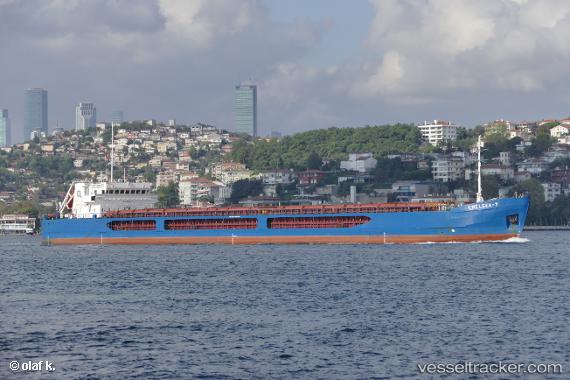
 Chelsea 7
Current Status
Where is the vessel?
Chelsea 7 is currently in 49 nm SE of Sveti Nikola, based on AIS data received about 14h ago.
Latest AIS update:
Current position: 43.06330° N, 29.48330° E (49 nm SE of Sveti Nikola)
Average speed (last 7 days): Loading…
Average speed (last 30 days): Loading…
Vessel profile: Chelsea 7 is a General Cargo Ship with dimensions 136m x 16m.
This page combines live AIS, route history, probable destination signals, nearby traffic, and port activity for practical vessel monitoring.
The current position of vessel Chelsea 7 is 43.0633 lat / 29.4833 lng. Updated: 2026-06-13 08:35:20 UTCNearest reference points:
- 54 nm SE of Sveti Nikola
- Near Shabla
- 20 nm E of Eforie Sud
Currently sailing under the flag of Malta ![]()
Chelsea 7 built in 2010 year
Deadweight:
6320 tDetails:
Live Vessel Chelsea 7 Analytics (details, animations, etc.)
Recent AIS points (UTC):
2026-06-13 07:47:26 UTC · 43.15830, 29.49830 · SOG 7 kn · COG -1°2026-06-13 07:47:26 UTC · 43.15830, 29.49830 · SOG 7 kn · COG -1°
2026-06-13 08:35:20 UTC · 43.06330, 29.48330 · SOG 7 kn · COG -1°
2026-06-13 08:35:20 UTC · 43.06330, 29.48330 · SOG 7 kn · COG -1°