 vesseltracker.com
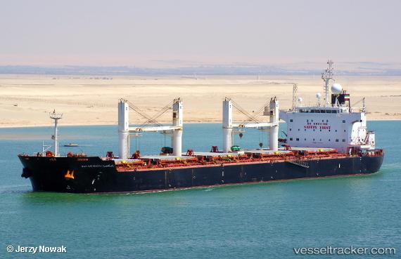
 Ras Ghumays i
Current Status
Where is the vessel?
Ras Ghumays i is currently in 145 nm E of Tan Cang Qui Nhon, based on AIS data received about 23h ago.
Latest AIS update:
Current position: 14.00465° N, 112.30530° E (145 nm E of Tan Cang Qui Nhon)
Average speed (last 7 days): Loading…
Average speed (last 30 days): Loading…
Vessel profile: Ras Ghumays i is a Bulk Carrier with dimensions 190m x 32m.
This page combines live AIS, route history, probable destination signals, nearby traffic, and port activity for practical vessel monitoring.
The current position of vessel Ras Ghumays i is 14.00465 lat / 112.30530 lng. Updated: 2026-05-01 21:12:41 UTCNearest reference points:
- 222 nm E of Tan Cang Qui Nhon
- 232 nm E of Tan Cang Qui Nhon
- 215 nm NE of Tan Cang Qui Nhon
Currently sailing under the flag of Liberia ![]()
Ras Ghumays i built in 2011 year
Deadweight:
57423 tDetails:
Live Vessel Ras Ghumays i Analytics (details, animations, etc.)
Recent AIS points (UTC):
2026-05-01 21:12:41 UTC · 14.00465, 112.30530 · SOG 13 kn · COG 207°2026-05-01 21:12:41 UTC · 14.00465, 112.30530 · SOG 13 kn · COG 207°
2026-05-01 21:12:41 UTC · 14.00465, 112.30530 · SOG 13 kn · COG 207°
2026-05-01 21:12:41 UTC · 14.00465, 112.30530 · SOG 13 kn · COG 207°