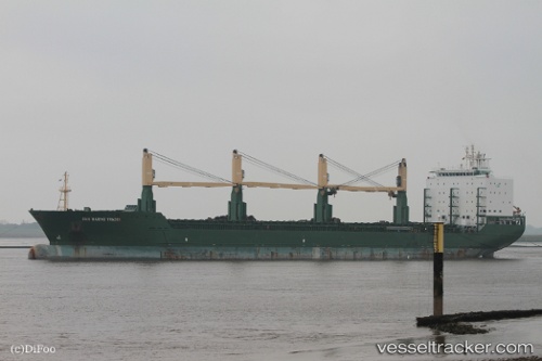
San Marino Trade
Current StatusWhere is the vessel?
San Marino Trade is currently in Open sea, approx. 465 nm off the nearest listed port, based on AIS data received about 14h ago.
Latest AIS update:
Current position: 33.56290° S, 39.32366° E (Open sea, approx. 465 nm off the nearest listed port)
Average speed (last 7 days): Loading…
Average speed (last 30 days): Loading…
Vessel profile: San Marino Trade is a Multi Purpose Carrier with dimensions 28m x 180m.
This page combines live AIS, route history, probable destination signals, nearby traffic, and port activity for practical vessel monitoring.
The current position of vessel San Marino Trade is -33.56290 lat / 39.32366 lng. Updated: 2026-05-24 10:20:49 UTCNearest reference points:
- Open sea, approx. 465 nm off the nearest listed port
- Open sea, approx. 470 nm off the nearest listed port
- Open sea, approx. 460 nm off the nearest listed port
Details:
Live Vessel San Marino Trade Analytics (details, animations, etc.)
Recent AIS points (UTC):
2026-05-24 05:52:28 UTC · -33.68156, 38.16876 · SOG 12.9 kn · COG 86°2026-05-24 07:27:54 UTC · -33.64838, 38.57971 · SOG 12.8 kn · COG 85°
2026-05-24 07:59:39 UTC · -33.63711, 38.71547 · SOG 12.9 kn · COG 85°
2026-05-24 10:20:49 UTC · -33.56290, 39.32366 · SOG 13.3 kn · COG 81°