 Waaldijk
Current Status
Where is the vessel?
Waaldijk is currently in 12 nm N of Roja, based on AIS data received about 14h ago.
Latest AIS update:
Current position: 57.70104° N, 22.87907° E (12 nm N of Roja)
Average speed (last 7 days): Loading…
Average speed (last 30 days): Loading…
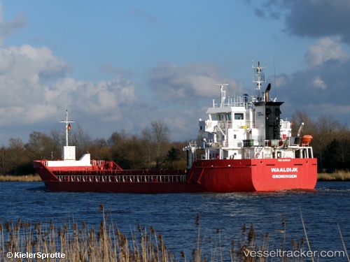
Vessel profile: Waaldijk is a Multi Purpose Carrier with dimensions 90m x 14m.
This page combines live AIS, route history, probable destination signals, nearby traffic, and port activity for practical vessel monitoring.
The current position of vessel Waaldijk is 57.70104 lat / 22.87907 lng. Updated: 2026-05-20 08:13:26 UTCNearest reference points:
- Near Bullu
- 18 nm N of Ventspils
- Near Riga
Currently sailing under the flag of Netherlands ![]()
Waaldijk built in 2010 year
Deadweight:
4891 tDetails:
Live Vessel Waaldijk Analytics (details, animations, etc.)
Recent AIS points (UTC):
2026-05-20 04:26:46 UTC · 57.76475, 21.73546 · SOG 11 kn · COG 139°2026-05-20 05:45:56 UTC · 57.72282, 22.14734 · SOG 10.8 kn · COG 62°
2026-05-20 07:37:36 UTC · 57.77934, 22.73440 · SOG 11 kn · COG 135°
2026-05-20 08:13:26 UTC · 57.70104, 22.87907 · SOG 10.9 kn · COG 137°